Land Maps
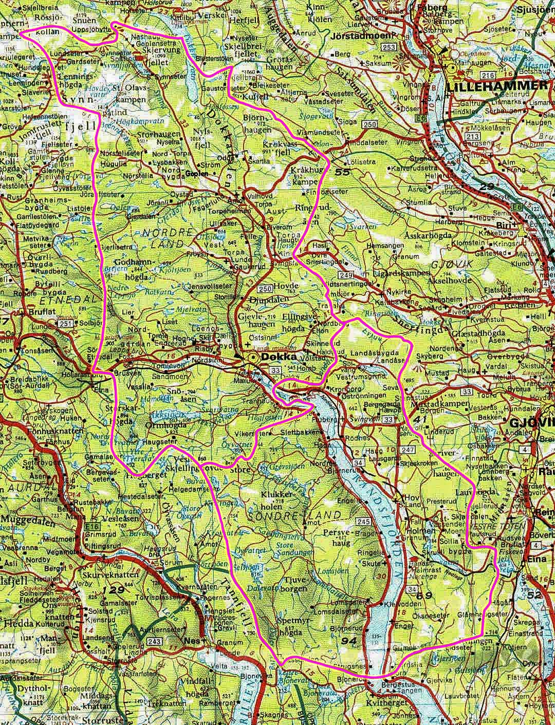
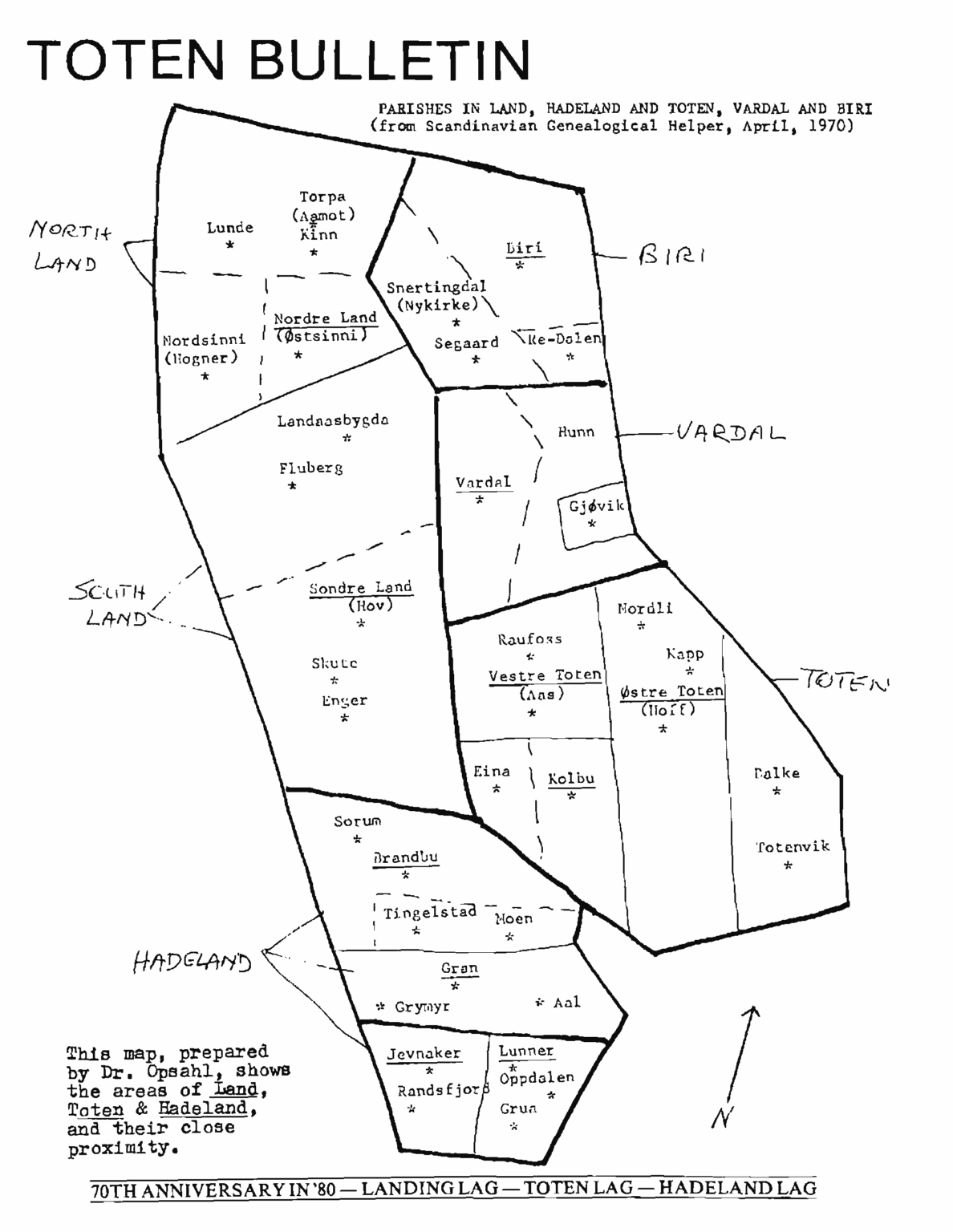
The first map below provides an overview of the locations of Nordre Land and Søndre Land (translated to North Land and South Land) within the county of Innlandet, Norway. Both are referred to as municipalities in Norway, similar to townships in the U.S. The second map offers a more detailed view of these two Land municipalities. The last two maps are taken from old Land newsletters. The third map shows the Land parishes, while the fourth highlights the subsections around Land.
The original Land municipality was established on January 1, 1838. Due to its size, it was divided into Nordre and Søndre Land in 1847. Since then, there have been a few boundary adjustments.
The county of Innlandet, Norway, was established on January 1, 2020, through the merger of the former counties of Oppland and Hedmark. Prior to 2020, Nordre and Søndre Land were part of Oppland county. Oppland (pronounced with a long “O”) had been in existence since 1781, and references to Oppland can still be found in texts and maps today.
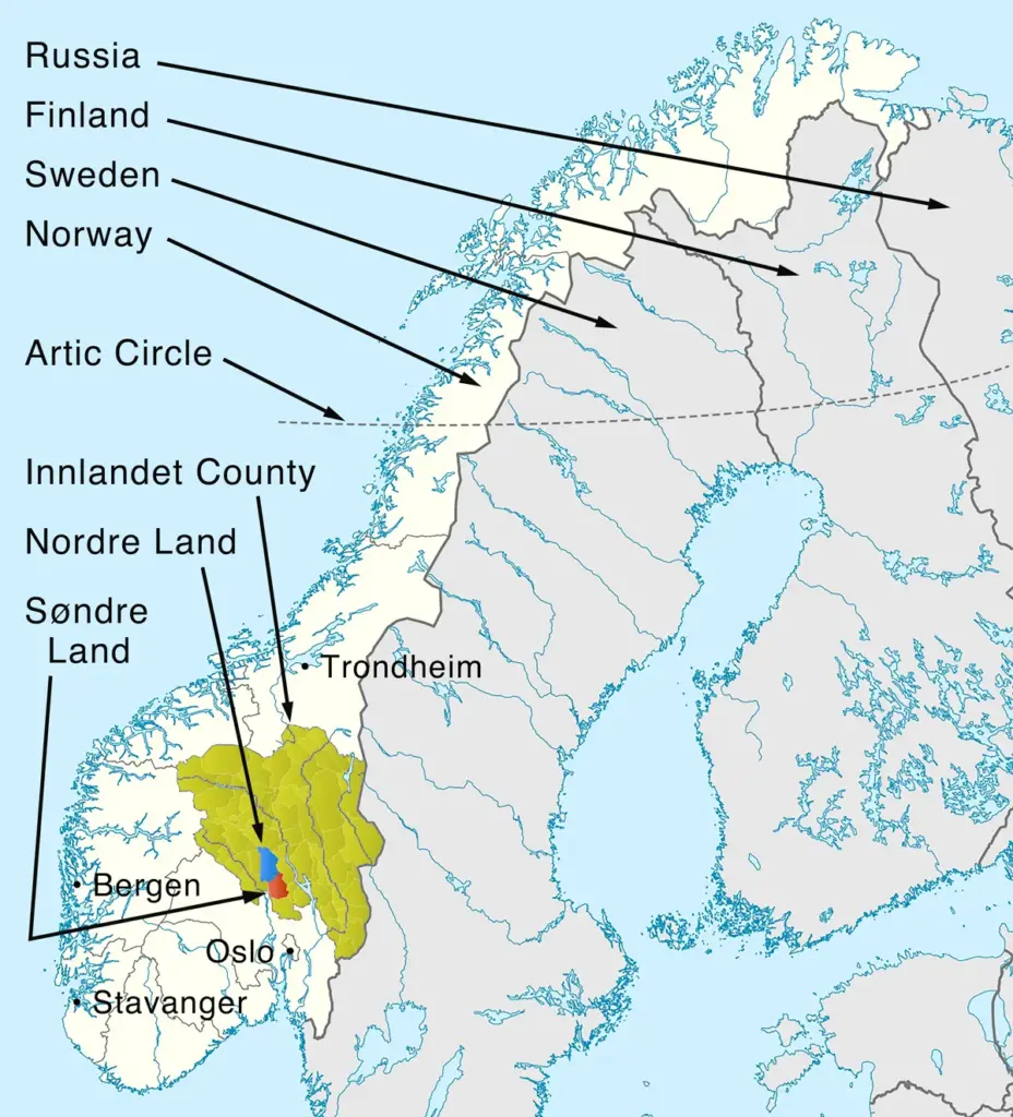
Some fun comparisons with the above map in mind:
- The bottom of Norway is nearly 600 miles north of the top of Minnesota – The southernmost point of mainland Norway (Lindesnes, ~57.98°N) lies approximately 594 miles north of the northernmost point of Minnesota (the Northwest Angle, ~49.38°N), based strictly on latitude.
- The top of Norway is about the same latitude as the top of Alaska – Point Barrow, Alaska (northernmost point of Alaska/the U.S., ~71.38°N) lies approximately 14 miles north of Kinnarodden (the true northernmost point of mainland Norway, on the Nordkinn peninsula, ~71.18°N), based strictly on latitude.
- Norway’s Svalbard archipelago is over 350 miles north of the top of Alaska – Point Barrow, Alaska (northernmost point, ~71.38°N) to Sørkapp (South Cape, the southernmost point of Svalbard, ~76.48°N): a difference of about 5.1 degrees of latitude, or approximately 352 miles, based strictly on latitude — with Svalbard’s southern tip lying that far north of Alaska’s northern tip. (Svalbard is not shown on the above map.)
- Norway is over 900 miles in height – The distance from south to north mainland Norway: Lindesnes (~57.98°N) to Kinnarodden (~71.18°N) spans about 13.2 degrees of latitude, or approximately 911 miles, based strictly on latitude.
- Norway’s height is over half the height of mainland U.S. – The southernmost point of the mainland United States (U.S.) is generally cited as Cape Sable, Florida (~25.12°N), and the northernmost point is the Northwest Angle, Minnesota (~49.38°N). That’s a difference of about 24.3 degrees, or approximately 1,674 miles, based strictly on latitude.