Land Maps
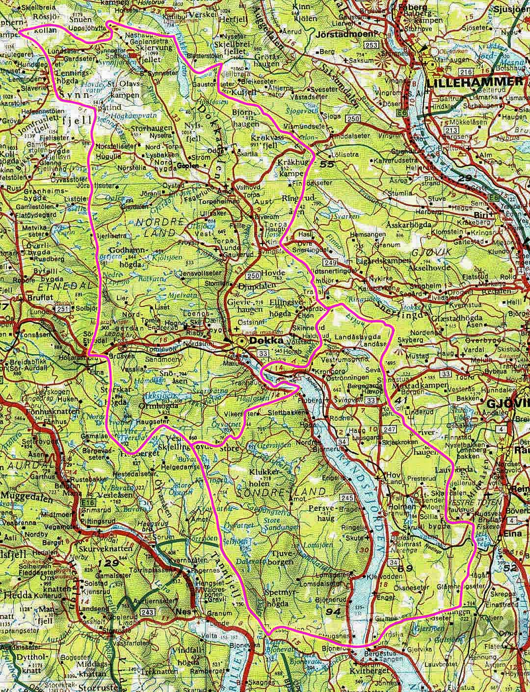
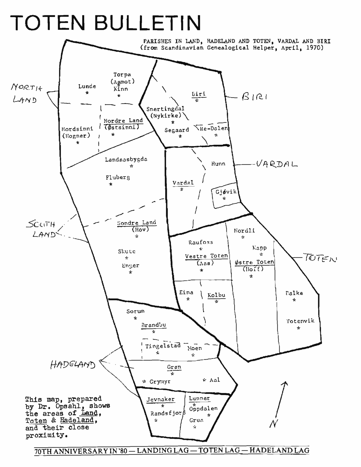
The first map below provides an overview of the locations of Nordre Land and Søndre Land (translated to North Land and South Land) within the county of Innlandet, Norway. Both are referred to as municipalities in Norway, similar to townships in the U.S. The second map offers a more detailed view of these two Land municipalities. The last two maps are taken from old Land newsletters. The third map shows the Land parishes, while the fourth highlights the subsections around Land.
The original Land municipality was established on January 1, 1838. Due to its size, it was divided into Nordre and Søndre Land in 1847. Since then, there have been a few boundary adjustments.
The county of Innlandet, Norway, was established on January 1, 2020, through the merger of the former counties of Oppland and Hedmark. Prior to 2020, Nordre and Søndre Land were part of Oppland county. Oppland (pronounced with a long “O”) had been in existence since 1781, and references to Oppland can still be found in texts and maps today.